ConnectGalaxy Logo
    • Pesquisa avançada
  • Visitante
    • Login
    • Registrar
    • Modo noturno
Satpalda Cover Image
User Image
Arraste para reposicionar a cobertura
Satpalda Profile Picture
Satpalda

@satpalda

  • Oś czasu
  • Grupos
  • Curtiu
  • Amigos
  • Fotos
  • Vídeos
  • Carretel
Satpalda profile picture Satpalda profile picture
Satpalda
17 C

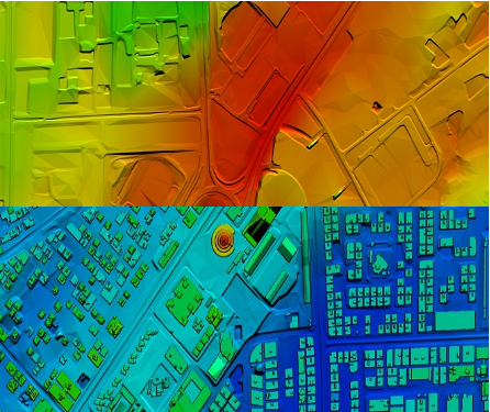
High-Resolution Digital Terrain Model (DTM) Services – Satpalda Geospatial Solutions

Discover precise and high-quality Digital Terrain Model (DTM) data with Satpalda, a leading geospatial service provider. Enhance your projects in civil engineering, hydrology, and land management with accurate terrain modeling and analysis. For more content us our official website. https://satpalda.co/digital-terrain-model-dtm/

Digital terrain model (DTM) | Digital elevation model (DEM) | Satpalda
satpalda.co

Digital terrain model (DTM) | Digital elevation model (DEM) | Satpalda

Digital terrain model (DTM), also known as Digital elevation model (DEM), is the practice of creating a digital representation of ground topography and terrain.
Curtir
Comentario
Compartilhar
Satpalda profile picture Satpalda profile picture
Satpalda
18 C

How are modern cities becoming smarter, more efficient, and sustainable?
Find out in Satpalda’s latest blog: “How GIS Surveys Are Used in Smart City Development.”
Geographic Information System (GIS) surveys are playing a critical role in designing the cities of tomorrow—enabling real-time data visualization, efficient infrastructure planning, and smarter governance. 💡 Whether you're a city planner, engineer, or tech enthusiast, this blog explains why GIS is the backbone of every successful smart city initiative.
👉 Read the full article now: https://satpalda.co/how-gis-su....rveys-are-used-in-sm

GIS Surveys Are Used in Smart City

A good town runs on plans. A map helps set that plan. But how? Geospatial tools track landand show what to build.
Curtir
Comentario
Compartilhar
Satpalda profile picture Satpalda profile picture
Satpalda
18 C

Explore Satpalda’s latest blog, “How AI is Enhancing Satellite Image Analysis,” and see how artificial intelligence is transforming the way we analyze Earth from space.
From automated land cover classification to real-time disaster monitoring, AI is streamlining workflows, increasing accuracy, and opening up new frontiers in geospatial intelligence.
🔹 Learn how AI accelerates image processing
🔹 Discover its role in land use mapping, agriculture, urban planning, and more
🔹 Find out why AI-driven analysis is becoming the new industry standard
👉 Read the full blog now: https://satpalda.co/how-ai-enh....ancing-satellite-ima

How AI Enhancing Satellite Image Analysis - SATPALDA

AI reads what the eye can’t see. Artificial satellite shots hold tons of facts, but they need AIto pick the key ones.
Curtir
Comentario
Compartilhar
Satpalda profile picture Satpalda profile picture
Satpalda
19 C

At Satpalda, we’re exploring how Artificial Intelligence is revolutionizing the way satellite imagery is processed, interpreted, and applied across industries.
In our latest blog, learn how AI-powered tools: ✅ Automate object detection
✅ Enhance land use classification
✅ Improve change detection
✅ Accelerate data interpretation for faster decision-making
Whether you're in agriculture, urban planning, defense, or environmental monitoring, this is a game-changer.
🔗 Dive into the details: https://satpalda.co/how-ai-enh....ancing-satellite-ima

#ai #satelliteimagery #geospatial #remotesensing #imageanalysis #satpalda #artificialintelligence #gis #smarttech

How AI Enhancing Satellite Image Analysis - SATPALDA

AI reads what the eye can’t see. Artificial satellite shots hold tons of facts, but they need AIto pick the key ones.
Curtir
Comentario
Compartilhar
Satpalda profile picture Satpalda profile picture
Satpalda Mudou sua imagem de perfil
19 C

image
Curtir
Comentario
Compartilhar
 Carregar mais posts
    Info
    • Homem
    • Postagens 6
  • Localização 1006, Kanchenjunga Building, 18, Barakhamba Road, New Delhi - 110001, India
  • https://satpalda.com/
Sobre

Satpalda Geospatial Services is a leading provider of satellite imagery and geospatial services and solutions to the user community. The company continues to successfully deliver a wide range of Photogrammetric and Remote Sensing Projects. Our cost-effective solutions cater to the broad spectrum of government and industry users.
    álbuns 
    (0)
    Amigos 
    (0)
    Curtiu 
    (1)
    Grupos 
    (0)

© 2025 ConnectGalaxy

Linguagem

  • Sobre
  • Diretório
  • Blog
  • Contato
  • Desenvolvedores
  • Mais
    • Privacidade
    • Termos de Uso
    • Peça um reembolso
    • Data Deletion Policy
    • Cookie Policy

Anular

Tem certeza de que quer desamor?

Denunciar este usuário

Importante!

Tem certeza de que deseja remover esse membro da sua família?

Você cutucou Satpalda

Novo membro foi adicionado com sucesso à sua lista de família!

Recorte seu avatar

avatar

© 2025 ConnectGalaxy

  • Início
  • Sobre
  • Contato
  • Privacidade
  • Termos de Uso
  • Peça um reembolso
  • Blog
  • Desenvolvedores
  • Mais
    • Data Deletion Policy
    • Cookie Policy
  • Linguagem

© 2025 ConnectGalaxy

  • Início
  • Sobre
  • Contato
  • Privacidade
  • Termos de Uso
  • Peça um reembolso
  • Blog
  • Desenvolvedores
  • Mais
    • Data Deletion Policy
    • Cookie Policy
  • Linguagem

Comentário relatado com sucesso.

O post foi adicionado com sucesso à sua linha de tempo!

Você atingiu seu limite de amigos 5000!

Erro de tamanho de arquivo: o arquivo excede permitido o limite (92 MB) e não pode ser carregado.

Seu vídeo está sendo processado, informaremos você quando estiver pronto para ver.

Não é possível carregar um arquivo: esse tipo de arquivo não é suportado.

Detetámos algum conteúdo adulto na imagem que carregou, por isso, recusámos o seu processo de carregamento.

Compartilhar postagem em um grupo

Compartilhar para uma página

Compartilhar para o usuário

Sua postagem foi enviada. Analisaremos seu conteúdo em breve.

Para fazer upload de imagens, vídeos e arquivos de áudio, é necessário atualizar para o membro profissional. Upgrade To Pro

Editar oferta

0%

Adicionar camada


Selecione uma imagem
Exclua sua camada
Tem certeza de que deseja excluir esta camada?

Rever

Para vender seu conteúdo e postagens, comece criando alguns pacotes. Monetização

Pague pela Wallet.

Adicionar pacote

Exclua seu endereço

Tem certeza de que deseja excluir este endereço?

Remova seu pacote de monetização

Tem certeza de que deseja excluir este pacote?

Cancelar subscrição

Tem certeza de que deseja cancelar a inscrição deste usuário? Lembre-se de que você não poderá visualizar nenhum conteúdo monetizado.

Alerta de pagamento

Você está prestes a comprar os itens, deseja prosseguir?
Peça um reembolso

Linguagem

  • Arabic
  • Bengali
  • Chinese
  • Croatian
  • Danish
  • Dutch
  • English
  • Filipino
  • French
  • German
  • Hebrew
  • Hindi
  • Indonesian
  • Italian
  • Japanese
  • Korean
  • Persian
  • Portuguese
  • Russian
  • Spanish
  • Swedish
  • Turkish
  • Urdu
  • Vietnamese