ConnectGalaxy Logo
    • Napredno pretraživanje
  • Gost
    • Prijaviti se
    • Registar
    • Dnevni režim
Satpalda Cover Image
User Image
Povucite za promjenu položaja poklopca
Satpalda Profile Picture
Satpalda

@satpalda

  • Vremenska Crta
  • grupe
  • sviđanja
  • Prijatelji
  • Fotografije
  • Video zapisi
  • Koluti
Satpalda profile picture Satpalda profile picture
Satpalda
17 u

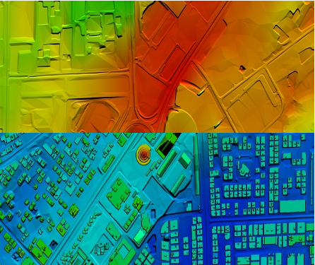
High-Resolution Digital Terrain Model (DTM) Services – Satpalda Geospatial Solutions

Discover precise and high-quality Digital Terrain Model (DTM) data with Satpalda, a leading geospatial service provider. Enhance your projects in civil engineering, hydrology, and land management with accurate terrain modeling and analysis. For more content us our official website. https://satpalda.co/digital-terrain-model-dtm/

Digital terrain model (DTM) | Digital elevation model (DEM) | Satpalda
satpalda.co

Digital terrain model (DTM) | Digital elevation model (DEM) | Satpalda

Digital terrain model (DTM), also known as Digital elevation model (DEM), is the practice of creating a digital representation of ground topography and terrain.
Kao
Komentar
Udio
Satpalda profile picture Satpalda profile picture
Satpalda
18 u

How are modern cities becoming smarter, more efficient, and sustainable?
Find out in Satpalda’s latest blog: “How GIS Surveys Are Used in Smart City Development.”
Geographic Information System (GIS) surveys are playing a critical role in designing the cities of tomorrow—enabling real-time data visualization, efficient infrastructure planning, and smarter governance. 💡 Whether you're a city planner, engineer, or tech enthusiast, this blog explains why GIS is the backbone of every successful smart city initiative.
👉 Read the full article now: https://satpalda.co/how-gis-su....rveys-are-used-in-sm

GIS Surveys Are Used in Smart City

A good town runs on plans. A map helps set that plan. But how? Geospatial tools track landand show what to build.
Kao
Komentar
Udio
Satpalda profile picture Satpalda profile picture
Satpalda
18 u

Explore Satpalda’s latest blog, “How AI is Enhancing Satellite Image Analysis,” and see how artificial intelligence is transforming the way we analyze Earth from space.
From automated land cover classification to real-time disaster monitoring, AI is streamlining workflows, increasing accuracy, and opening up new frontiers in geospatial intelligence.
🔹 Learn how AI accelerates image processing
🔹 Discover its role in land use mapping, agriculture, urban planning, and more
🔹 Find out why AI-driven analysis is becoming the new industry standard
👉 Read the full blog now: https://satpalda.co/how-ai-enh....ancing-satellite-ima

How AI Enhancing Satellite Image Analysis - SATPALDA

AI reads what the eye can’t see. Artificial satellite shots hold tons of facts, but they need AIto pick the key ones.
Kao
Komentar
Udio
Satpalda profile picture Satpalda profile picture
Satpalda
19 u

At Satpalda, we’re exploring how Artificial Intelligence is revolutionizing the way satellite imagery is processed, interpreted, and applied across industries.
In our latest blog, learn how AI-powered tools: ✅ Automate object detection
✅ Enhance land use classification
✅ Improve change detection
✅ Accelerate data interpretation for faster decision-making
Whether you're in agriculture, urban planning, defense, or environmental monitoring, this is a game-changer.
🔗 Dive into the details: https://satpalda.co/how-ai-enh....ancing-satellite-ima

#ai #satelliteimagery #geospatial #remotesensing #imageanalysis #satpalda #artificialintelligence #gis #smarttech

How AI Enhancing Satellite Image Analysis - SATPALDA

AI reads what the eye can’t see. Artificial satellite shots hold tons of facts, but they need AIto pick the key ones.
Kao
Komentar
Udio
Satpalda profile picture Satpalda profile picture
Satpalda promijenio profilnu sliku
19 u

image
Kao
Komentar
Udio
 Učitaj još postova
    Info
    • Muški
    • postovi 6
  • Smješten u 1006, Kanchenjunga Building, 18, Barakhamba Road, New Delhi - 110001, India
  • https://satpalda.com/
Oko

Satpalda Geospatial Services is a leading provider of satellite imagery and geospatial services and solutions to the user community. The company continues to successfully deliver a wide range of Photogrammetric and Remote Sensing Projects. Our cost-effective solutions cater to the broad spectrum of government and industry users.
    Albumi 
    (0)
    Prijatelji 
    (0)
    sviđanja 
    (1)
    grupe 
    (0)

© 2025 ConnectGalaxy

Jezik

  • Oko
  • Imenik
  • Blog
  • Kontaktirajte nas
  • Programeri
  • Više
    • Politika privatnosti
    • Uvjeti korištenja
    • Zatražite povrat novca
    • Data Deletion Policy
    • Cookie Policy

Ukini prijateljstvo

Jeste li sigurni da želite prekinuti prijateljstvo?

Prijavi ovog korisnika

Važno!

Jeste li sigurni da želite ukloniti ovog člana iz svoje obitelji?

Bockali ste Satpalda

Novi član je uspješno dodan na vaš obiteljski popis!

Izrežite svoj avatar

avatar

© 2025 ConnectGalaxy

  • Dom
  • Oko
  • Kontaktirajte nas
  • Politika privatnosti
  • Uvjeti korištenja
  • Zatražite povrat novca
  • Blog
  • Programeri
  • Više
    • Data Deletion Policy
    • Cookie Policy
  • Jezik

© 2025 ConnectGalaxy

  • Dom
  • Oko
  • Kontaktirajte nas
  • Politika privatnosti
  • Uvjeti korištenja
  • Zatražite povrat novca
  • Blog
  • Programeri
  • Više
    • Data Deletion Policy
    • Cookie Policy
  • Jezik

Komentar je uspješno prijavljen.

Objava je uspješno dodana na vašu vremensku traku!

Dosegli ste ograničenje od 5000 prijatelja!

Pogreška veličine datoteke: datoteka premašuje dopušteno ograničenje (92 MB) i ne može se učitati.

Vaš se videozapis obrađuje. Obavijestit ćemo vas kada bude spreman za gledanje.

Nije moguće učitati datoteku: ova vrsta datoteke nije podržana.

Otkrili smo sadržaj za odrasle na slici koju ste prenijeli, stoga smo odbili vaš postupak učitavanja.

Podijelite objavu u grupi

Podijelite na stranicu

Podijeli s korisnikom

Vaš je post poslan, uskoro ćemo pregledati vaš sadržaj.

Za prijenos slika, videozapisa i audio datoteka morate nadograditi na pro člana. Nadogradi na pro

Uredi ponudu

0%

Dodajte razinu


Odaberite sliku
Izbrišite svoju razinu
Jeste li sigurni da želite izbrisati ovu razinu?

Recenzije

Kako biste prodali svoj sadržaj i postove, počnite s stvaranjem nekoliko paketa. Monetizacija

Plaćanje novčanikom

Dodaj paket

Izbriši svoju adresu

Jeste li sigurni da želite izbrisati ovu adresu?

Uklonite svoj paket monetizacije

Jeste li sigurni da želite izbrisati ovaj paket?

Odjavi pretplatu

Jeste li sigurni da želite otkazati pretplatu na ovog korisnika? Imajte na umu da nećete moći vidjeti njihov unovčeni sadržaj.

Upozorenje o plaćanju

Spremate se kupiti artikle, želite li nastaviti?
Zatražite povrat novca

Jezik

  • Arabic
  • Bengali
  • Chinese
  • Croatian
  • Danish
  • Dutch
  • English
  • Filipino
  • French
  • German
  • Hebrew
  • Hindi
  • Indonesian
  • Italian
  • Japanese
  • Korean
  • Persian
  • Portuguese
  • Russian
  • Spanish
  • Swedish
  • Turkish
  • Urdu
  • Vietnamese