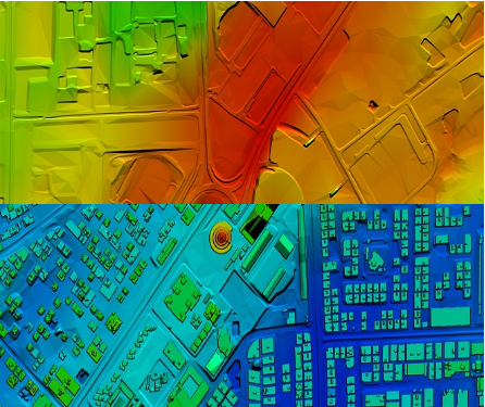
High-Resolution Digital Terrain Model (DTM) Services – Satpalda Geospatial Solutions
Discover precise and high-quality Digital Terrain Model (DTM) data with Satpalda, a leading geospatial service provider. Enhance your projects in civil engineering, hydrology, and land management with accurate terrain modeling and analysis. For more content us our official website. https://satpalda.co/digital-terrain-model-dtm/
How are modern cities becoming smarter, more efficient, and sustainable?
Find out in Satpalda’s latest blog: “How GIS Surveys Are Used in Smart City Development.”
Geographic Information System (GIS) surveys are playing a critical role in designing the cities of tomorrow—enabling real-time data visualization, efficient infrastructure planning, and smarter governance. 💡 Whether you're a city planner, engineer, or tech enthusiast, this blog explains why GIS is the backbone of every successful smart city initiative.
👉 Read the full article now: https://satpalda.co/how-gis-su....rveys-are-used-in-sm
Explore Satpalda’s latest blog, “How AI is Enhancing Satellite Image Analysis,” and see how artificial intelligence is transforming the way we analyze Earth from space.
From automated land cover classification to real-time disaster monitoring, AI is streamlining workflows, increasing accuracy, and opening up new frontiers in geospatial intelligence.
🔹 Learn how AI accelerates image processing
🔹 Discover its role in land use mapping, agriculture, urban planning, and more
🔹 Find out why AI-driven analysis is becoming the new industry standard
👉 Read the full blog now: https://satpalda.co/how-ai-enh....ancing-satellite-ima
At Satpalda, we’re exploring how Artificial Intelligence is revolutionizing the way satellite imagery is processed, interpreted, and applied across industries.
In our latest blog, learn how AI-powered tools: ✅ Automate object detection
✅ Enhance land use classification
✅ Improve change detection
✅ Accelerate data interpretation for faster decision-making
Whether you're in agriculture, urban planning, defense, or environmental monitoring, this is a game-changer.
🔗 Dive into the details: https://satpalda.co/how-ai-enh....ancing-satellite-ima
#ai #satelliteimagery #geospatial #remotesensing #imageanalysis #satpalda #artificialintelligence #gis #smarttech
Satpalda Geospatial Services is a leading provider of satellite imagery and geospatial services and solutions to the user community. The company continues to successfully deliver a wide range of Photogrammetric and Remote Sensing Projects. Our cost-effective solutions cater to the broad spectrum of government and industry users.


