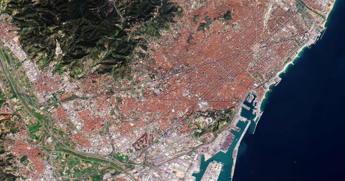
Unlocking the Secrets of Earth: Key Components of Remote Sensing Explained
In our latest blog, “Components of Remote Sensing”, we break down the essential building blocks behind this powerful technology. Whether you're new to geospatial science or looking to refresh your understanding, this blog provides valuable insights into how raw satellite data transforms into actionable intelligence. With real-world examples and simplified explanations, it’s your go-to guide for mastering the fundamentals.
Ready to explore the science that fuels modern Earth observation?
👉 Read the full article now: https://satpalda.co/components-of-remote-sensing/
#remotesensing #geospatialtechnology #earthobservation #satpalda #gis
Transforming Mapping with Aerial Photogrammetry 🛰️📷
Want high-precision 3D maps from above? Discover how aerial photogrammetry is reshaping surveying, urban planning, and construction projects.
Satpalda’s latest blog breaks down the technology, benefits, and real-world applications of aerial photogrammetry in modern geospatial analysis.
✅ Generate accurate topographic maps
✅ Support large-scale infrastructure planning
✅ Save time and cost with remote data capture
👉 Read now: https://satpalda.com/aerial-photogrammetry/
#aerialphotogrammetry #remotesensing #geospatialtechnology #satpalda #3dmapping #surveying #dronemapping
Unlock High-Resolution Earth Imagery with QuickBird Satellite
Looking for precise and detailed satellite imagery for your GIS, mapping, or environmental projects?
Explore Satpalda’s latest blog on the QuickBird Satellite – one of the most reliable high-resolution Earth observation satellites used globally.
📡 Learn how QuickBird delivers detailed imagery up to 0.61m resolution
🌐 Understand its applications in urban planning, agriculture, and disaster response
🛰️ See how Satpalda leverages QuickBird data for powerful geospatial insights
👉 Dive into the full blog here: https://satpalda.com/quick-bird-satellite/
#quickbird #satelliteimagery #remotesensing #geospatialdata #satpalda #earthobservation
Unlock the Power of Location Intelligence with Geospatial Technology
Curious about how satellite imagery, GPS, and GIS are transforming industries from agriculture to urban planning?
Dive into Satpalda’s latest blog: “What is Geospatial Technology?”
Learn how this cutting-edge tech is shaping smarter decisions, optimizing operations, and solving real-world challenges with location-based insights.
🔍 Understand the core components of geospatial tech
🌐 Explore real-world applications across multiple sectors
🚀 See how businesses and governments are leveraging spatial data for impact
👉 Read now: https://satpalda.com/what-is-g....ospatial-technology/
#geospatialtechnology #gis #remotesensing #satpalda #locationintelligence #smartmapping #digitaltransformation
Explore the Power of Remote Sensing and Its Application | Satpalda
Discover how remote sensing and its application are transforming industries like agriculture, urban planning, disaster management, and more! Satpalda’s latest blog dives into real-world use cases and explains how cutting-edge geospatial technology delivers accurate, real-time insights for smarter decision-making. Learn how Satpalda leverages satellite imagery and advanced analytics to solve complex challenges across the globe. Whether you're a researcher, planner, or business leader — for more information contact us our official website.
👉 Read now: https://satpalda.com/
#remotesensing #geospatialsolutions #satpalda #smartmapping #gis
 News Feed
  Albums
  Popular Posts
  Memories
  Pokes
Pokes  Blog
Blog  Market
  Directory
  Events
  Games
Games  Jobs
Jobs  Offers
  Find friends
  Common Things
  Fundings


