ConnectGalaxy Logo
    • Recherche Avancée
  • Client
    • S'identifier
    • Enregistrez
    • Mode nuit
Satpalda Cover Image
User Image
Faites glisser pour repositionner la couverture
Satpalda Profile Picture
Satpalda

@satpalda

  • Chronologie
  • Groupes
  • Aime
  • Friends
  • Photos
  • Les vidéos
  • Bobines
Satpalda profile picture Satpalda profile picture
Satpalda
17 w

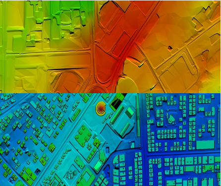
High-Resolution Digital Terrain Model (DTM) Services – Satpalda Geospatial Solutions

Discover precise and high-quality Digital Terrain Model (DTM) data with Satpalda, a leading geospatial service provider. Enhance your projects in civil engineering, hydrology, and land management with accurate terrain modeling and analysis. For more content us our official website. https://satpalda.co/digital-terrain-model-dtm/

Digital terrain model (DTM) | Digital elevation model (DEM) | Satpalda
satpalda.co

Digital terrain model (DTM) | Digital elevation model (DEM) | Satpalda

Digital terrain model (DTM), also known as Digital elevation model (DEM), is the practice of creating a digital representation of ground topography and terrain.
Aimer
Commentaire
Partagez
Satpalda profile picture Satpalda profile picture
Satpalda
18 w

How are modern cities becoming smarter, more efficient, and sustainable?
Find out in Satpalda’s latest blog: “How GIS Surveys Are Used in Smart City Development.”
Geographic Information System (GIS) surveys are playing a critical role in designing the cities of tomorrow—enabling real-time data visualization, efficient infrastructure planning, and smarter governance. 💡 Whether you're a city planner, engineer, or tech enthusiast, this blog explains why GIS is the backbone of every successful smart city initiative.
👉 Read the full article now: https://satpalda.co/how-gis-su....rveys-are-used-in-sm

GIS Surveys Are Used in Smart City

A good town runs on plans. A map helps set that plan. But how? Geospatial tools track landand show what to build.
Aimer
Commentaire
Partagez
Satpalda profile picture Satpalda profile picture
Satpalda
18 w

Explore Satpalda’s latest blog, “How AI is Enhancing Satellite Image Analysis,” and see how artificial intelligence is transforming the way we analyze Earth from space.
From automated land cover classification to real-time disaster monitoring, AI is streamlining workflows, increasing accuracy, and opening up new frontiers in geospatial intelligence.
🔹 Learn how AI accelerates image processing
🔹 Discover its role in land use mapping, agriculture, urban planning, and more
🔹 Find out why AI-driven analysis is becoming the new industry standard
👉 Read the full blog now: https://satpalda.co/how-ai-enh....ancing-satellite-ima

How AI Enhancing Satellite Image Analysis - SATPALDA

AI reads what the eye can’t see. Artificial satellite shots hold tons of facts, but they need AIto pick the key ones.
Aimer
Commentaire
Partagez
Satpalda profile picture Satpalda profile picture
Satpalda
19 w

At Satpalda, we’re exploring how Artificial Intelligence is revolutionizing the way satellite imagery is processed, interpreted, and applied across industries.
In our latest blog, learn how AI-powered tools: ✅ Automate object detection
✅ Enhance land use classification
✅ Improve change detection
✅ Accelerate data interpretation for faster decision-making
Whether you're in agriculture, urban planning, defense, or environmental monitoring, this is a game-changer.
🔗 Dive into the details: https://satpalda.co/how-ai-enh....ancing-satellite-ima

#ai #satelliteimagery #geospatial #remotesensing #imageanalysis #satpalda #artificialintelligence #gis #smarttech

How AI Enhancing Satellite Image Analysis - SATPALDA

AI reads what the eye can’t see. Artificial satellite shots hold tons of facts, but they need AIto pick the key ones.
Aimer
Commentaire
Partagez
Satpalda profile picture Satpalda profile picture
Satpalda Changé sa photo de profil
19 w

image
Aimer
Commentaire
Partagez
 Chargez plus de postes
    Info
    • Mâle
    • des postes 6
  • Situé dans 1006, Kanchenjunga Building, 18, Barakhamba Road, New Delhi - 110001, India
  • https://satpalda.com/
Sur

Satpalda Geospatial Services is a leading provider of satellite imagery and geospatial services and solutions to the user community. The company continues to successfully deliver a wide range of Photogrammetric and Remote Sensing Projects. Our cost-effective solutions cater to the broad spectrum of government and industry users.
    Albums 
    (0)
    Friends 
    (0)
    Aime 
    (1)
    Groupes 
    (0)

© 2025 ConnectGalaxy

Langue

  • Sur
  • Annuaire
  • Blog
  • Contactez nous
  • Développeurs
  • Plus
    • politique de confidentialité
    • Conditions d'utilisation
    • Demande à être remboursé
    • Data Deletion Policy
    • Cookie Policy

Désamie

Êtes-vous sûr de vouloir vous libérer?

Signaler cet utilisateur

Important!

Êtes-vous sûr de vouloir supprimer ce membre de votre famille?

Vous avez fourré Satpalda

Un nouveau membre a été ajouté avec succès à votre liste de famille!

Recadrez votre avatar

avatar

© 2025 ConnectGalaxy

  • Domicile
  • Sur
  • Contactez nous
  • politique de confidentialité
  • Conditions d'utilisation
  • Demande à être remboursé
  • Blog
  • Développeurs
  • Plus
    • Data Deletion Policy
    • Cookie Policy
  • Langue

© 2025 ConnectGalaxy

  • Domicile
  • Sur
  • Contactez nous
  • politique de confidentialité
  • Conditions d'utilisation
  • Demande à être remboursé
  • Blog
  • Développeurs
  • Plus
    • Data Deletion Policy
    • Cookie Policy
  • Langue

Commentaire signalé avec succès.

Le message a été ajouté avec succès à votre calendrier!

Vous avez atteint la limite de vos amis 5000!

Erreur de taille de fichier: le fichier dépasse autorisé la limite ({image_fichier}) et ne peut pas être téléchargé.

Votre vidéo est en cours de traitement, nous vous ferons savoir quand il est prêt à voir.

Impossible de télécharger un fichier : ce type de fichier n'est pas pris en charge.

Nous avons détecté du contenu réservé aux adultes sur l'image que vous avez téléchargée. Par conséquent, nous avons refusé votre processus de téléchargement.

Partager un post sur un groupe

Partager sur une page

Partager avec l'utilisateur

Votre message a été envoyé, nous examinerons bientôt votre contenu.

Pour télécharger des images, des vidéos et des fichiers audio, vous devez passer à un membre pro. Passer à Pro

Modifier loffre

0%

Ajouter un niveau


Sélectionnez une image
Supprimer votre niveau
Êtes-vous sûr de vouloir supprimer ce niveau?

Avis

Afin de vendre votre contenu et vos publications, commencez par créer quelques packages. Monétisation

Payer par portefeuille

Ajouter un paquet

Supprimer votre adresse

Êtes-vous sûr de vouloir supprimer cette adresse?

Supprimez votre package de monétisation

Êtes-vous sûr de vouloir supprimer ce package ?

Se désabonner

Etes-vous sûr de vouloir vous désabonner de cet utilisateur ? Gardez à l’esprit que vous ne pourrez voir aucun de leur contenu monétisé.

Alerte de paiement

Vous êtes sur le point d'acheter les articles, voulez-vous continuer?
Demande à être remboursé

Langue

  • Arabic
  • Bengali
  • Chinese
  • Croatian
  • Danish
  • Dutch
  • English
  • Filipino
  • French
  • German
  • Hebrew
  • Hindi
  • Indonesian
  • Italian
  • Japanese
  • Korean
  • Persian
  • Portuguese
  • Russian
  • Spanish
  • Swedish
  • Turkish
  • Urdu
  • Vietnamese