ConnectGalaxy Logo
    • جستجوی پیشرفته
  • مهمان
    • وارد شدن
    • ثبت نام
    • حالت شب
Satpalda Cover Image
User Image
برای تغییر مکان پوشش بکشید
Satpalda Profile Picture
Satpalda

@satpalda

  • جدول زمانی
  • گروه ها
  • دوست دارد
  • دوستان
  • عکس ها
  • فیلم های
  • قرقره ها
Satpalda profile picture Satpalda profile picture
Satpalda
17 که در

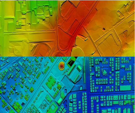
High-Resolution Digital Terrain Model (DTM) Services – Satpalda Geospatial Solutions

Discover precise and high-quality Digital Terrain Model (DTM) data with Satpalda, a leading geospatial service provider. Enhance your projects in civil engineering, hydrology, and land management with accurate terrain modeling and analysis. For more content us our official website. https://satpalda.co/digital-terrain-model-dtm/

Digital terrain model (DTM) | Digital elevation model (DEM) | Satpalda
satpalda.co

Digital terrain model (DTM) | Digital elevation model (DEM) | Satpalda

Digital terrain model (DTM), also known as Digital elevation model (DEM), is the practice of creating a digital representation of ground topography and terrain.
پسندیدن
اظهار نظر
اشتراک گذاری
Satpalda profile picture Satpalda profile picture
Satpalda
18 که در

How are modern cities becoming smarter, more efficient, and sustainable?
Find out in Satpalda’s latest blog: “How GIS Surveys Are Used in Smart City Development.”
Geographic Information System (GIS) surveys are playing a critical role in designing the cities of tomorrow—enabling real-time data visualization, efficient infrastructure planning, and smarter governance. 💡 Whether you're a city planner, engineer, or tech enthusiast, this blog explains why GIS is the backbone of every successful smart city initiative.
👉 Read the full article now: https://satpalda.co/how-gis-su....rveys-are-used-in-sm

GIS Surveys Are Used in Smart City

A good town runs on plans. A map helps set that plan. But how? Geospatial tools track landand show what to build.
پسندیدن
اظهار نظر
اشتراک گذاری
Satpalda profile picture Satpalda profile picture
Satpalda
18 که در

Explore Satpalda’s latest blog, “How AI is Enhancing Satellite Image Analysis,” and see how artificial intelligence is transforming the way we analyze Earth from space.
From automated land cover classification to real-time disaster monitoring, AI is streamlining workflows, increasing accuracy, and opening up new frontiers in geospatial intelligence.
🔹 Learn how AI accelerates image processing
🔹 Discover its role in land use mapping, agriculture, urban planning, and more
🔹 Find out why AI-driven analysis is becoming the new industry standard
👉 Read the full blog now: https://satpalda.co/how-ai-enh....ancing-satellite-ima

How AI Enhancing Satellite Image Analysis - SATPALDA

AI reads what the eye can’t see. Artificial satellite shots hold tons of facts, but they need AIto pick the key ones.
پسندیدن
اظهار نظر
اشتراک گذاری
Satpalda profile picture Satpalda profile picture
Satpalda
19 که در

At Satpalda, we’re exploring how Artificial Intelligence is revolutionizing the way satellite imagery is processed, interpreted, and applied across industries.
In our latest blog, learn how AI-powered tools: ✅ Automate object detection
✅ Enhance land use classification
✅ Improve change detection
✅ Accelerate data interpretation for faster decision-making
Whether you're in agriculture, urban planning, defense, or environmental monitoring, this is a game-changer.
🔗 Dive into the details: https://satpalda.co/how-ai-enh....ancing-satellite-ima

#ai #satelliteimagery #geospatial #remotesensing #imageanalysis #satpalda #artificialintelligence #gis #smarttech

How AI Enhancing Satellite Image Analysis - SATPALDA

AI reads what the eye can’t see. Artificial satellite shots hold tons of facts, but they need AIto pick the key ones.
پسندیدن
اظهار نظر
اشتراک گذاری
Satpalda profile picture Satpalda profile picture
Satpalda عکس پروفایلش را تغییر داد
19 که در

image
پسندیدن
اظهار نظر
اشتراک گذاری
 بارگذاری پست های بیشتر
    اطلاعات
    • نر
    • نوشته ها 6
  • واقع در 1006, Kanchenjunga Building, 18, Barakhamba Road, New Delhi - 110001, India
  • https://satpalda.com/
در باره

Satpalda Geospatial Services is a leading provider of satellite imagery and geospatial services and solutions to the user community. The company continues to successfully deliver a wide range of Photogrammetric and Remote Sensing Projects. Our cost-effective solutions cater to the broad spectrum of government and industry users.
    آلبوم ها 
    (0)
    دوستان 
    (0)
    دوست دارد 
    (1)
    گروه ها 
    (0)

© 2025 ConnectGalaxy

زبان

  • در باره
  • فهرست راهنما
  • وبلاگ
  • با ما تماس بگیرید
  • توسعه دهندگان
  • بیشتر
    • سیاست حفظ حریم خصوصی
    • شرایط استفاده
    • درخواست بازپرداخت
    • Data Deletion Policy
    • Cookie Policy

بی دوست

آیا مطمئن هستید که می خواهید دوست خود را لغو کنید؟

گزارش این کاربر

مهم!

آیا مطمئن هستید که می خواهید این عضو را از خانواده خود حذف کنید؟

شما پوک کرده اید Satpalda

عضو جدید با موفقیت به لیست خانواده شما اضافه شد!

آواتار خود را برش دهید

avatar

© 2025 ConnectGalaxy

  • صفحه اصلی
  • در باره
  • با ما تماس بگیرید
  • سیاست حفظ حریم خصوصی
  • شرایط استفاده
  • درخواست بازپرداخت
  • وبلاگ
  • توسعه دهندگان
  • بیشتر
    • Data Deletion Policy
    • Cookie Policy
  • زبان

© 2025 ConnectGalaxy

  • صفحه اصلی
  • در باره
  • با ما تماس بگیرید
  • سیاست حفظ حریم خصوصی
  • شرایط استفاده
  • درخواست بازپرداخت
  • وبلاگ
  • توسعه دهندگان
  • بیشتر
    • Data Deletion Policy
    • Cookie Policy
  • زبان

نظر با موفقیت گزارش شد.

پست با موفقیت به جدول زمانی شما اضافه شد!

شما به حد مجاز 5000 دوست خود رسیده اید!

خطای اندازه فایل: فایل از حد مجاز (92 MB) فراتر رفته و نمی توان آن را آپلود کرد.

ویدیوی شما در حال پردازش است، زمانی که برای مشاهده آماده شد به شما اطلاع خواهیم داد.

امکان آپلود فایل وجود ندارد: این نوع فایل پشتیبانی نمی شود.

ما برخی از محتوای بزرگسالان را در تصویری که آپلود کرده‌اید شناسایی کرده‌ایم، بنابراین روند آپلود شما را رد کرده‌ایم.

پست را در یک گروه به اشتراک بگذارید

اشتراک گذاری در یک صفحه

اشتراک گذاری با کاربر

پست شما ارسال شد، به زودی محتوای شما را بررسی خواهیم کرد.

برای آپلود تصاویر، ویدئوها و فایل های صوتی، باید به عضو حرفه ای ارتقا دهید. پیشرفت

ویرایش پیشنهاد

0%

افزودن ردیف


یک تصویر را انتخاب کنید
لایه خود را حذف کنید
آیا مطمئن هستید که می خواهید این ردیف را حذف کنید؟

بررسی ها

برای فروش محتوا و پست های خود، با ایجاد چند بسته شروع کنید. کسب درآمد

پرداخت با کیف پول

افزودن بسته

آدرس خود را حذف کنید

آیا مطمئن هستید که می خواهید این آدرس را حذف کنید؟

بسته کسب درآمد خود را حذف کنید

آیا مطمئن هستید که می خواهید این بسته را حذف کنید؟

لغو اشتراک

آیا مطمئنید که می خواهید اشتراک این کاربر را لغو کنید؟ به خاطر داشته باشید که نمی‌توانید هیچ یک از محتوای درآمدزایی آنها را مشاهده کنید.

هشدار پرداخت

شما در حال خرید اقلام هستید، آیا می خواهید ادامه دهید؟
درخواست بازپرداخت

زبان

  • Arabic
  • Bengali
  • Chinese
  • Croatian
  • Danish
  • Dutch
  • English
  • Filipino
  • French
  • German
  • Hebrew
  • Hindi
  • Indonesian
  • Italian
  • Japanese
  • Korean
  • Persian
  • Portuguese
  • Russian
  • Spanish
  • Swedish
  • Turkish
  • Urdu
  • Vietnamese