 News Feed
  Albums
  Popular Posts
  Memories
  Pokes
Pokes  Blog
Blog  Market
  Directory
  Events
  Games
Games  Jobs
Jobs  Offers
  Find friends
  Common Things
  Fundings
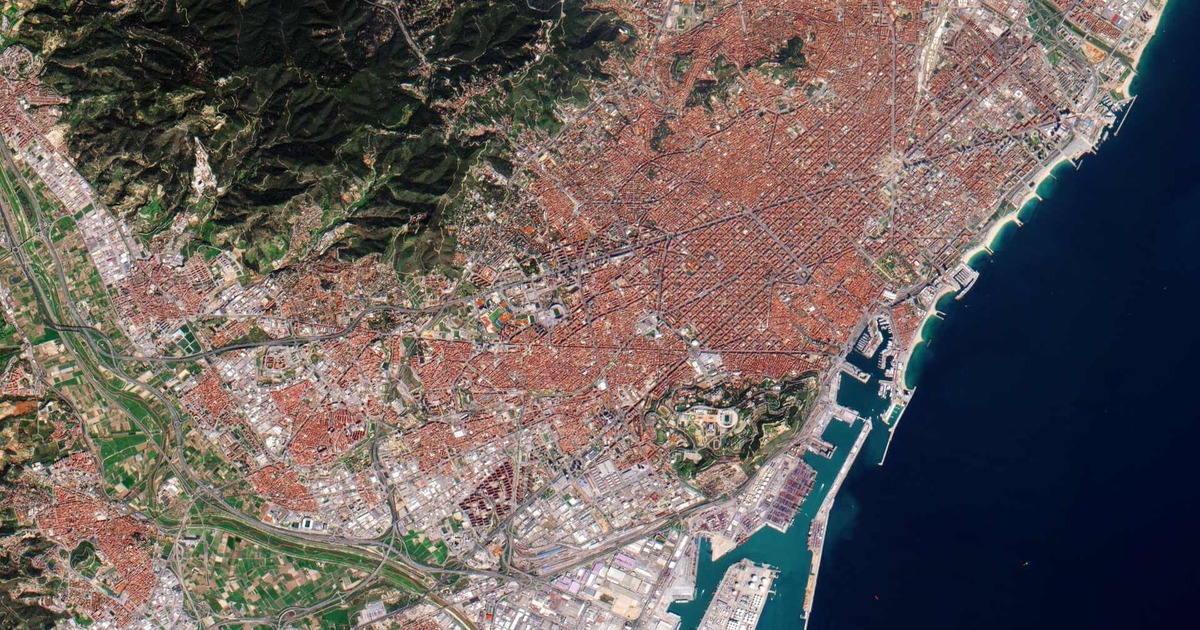
Unlock High-Resolution Earth Imagery with QuickBird Satellite
Looking for precise and detailed satellite imagery for your GIS, mapping, or environmental projects?
Explore Satpalda’s latest blog on the QuickBird Satellite – one of the most reliable high-resolution Earth observation satellites used globally.
📡 Learn how QuickBird delivers detailed imagery up to 0.61m resolution
🌐 Understand its applications in urban planning, agriculture, and disaster response
🛰️ See how Satpalda leverages QuickBird data for powerful geospatial insights
👉 Dive into the full blog here: https://satpalda.com/quick-bird-satellite/
#quickbird #satelliteimagery #remotesensing #geospatialdata #satpalda #earthobservation
Like


Comment
Share